Gimme Shelter! (AT Style)

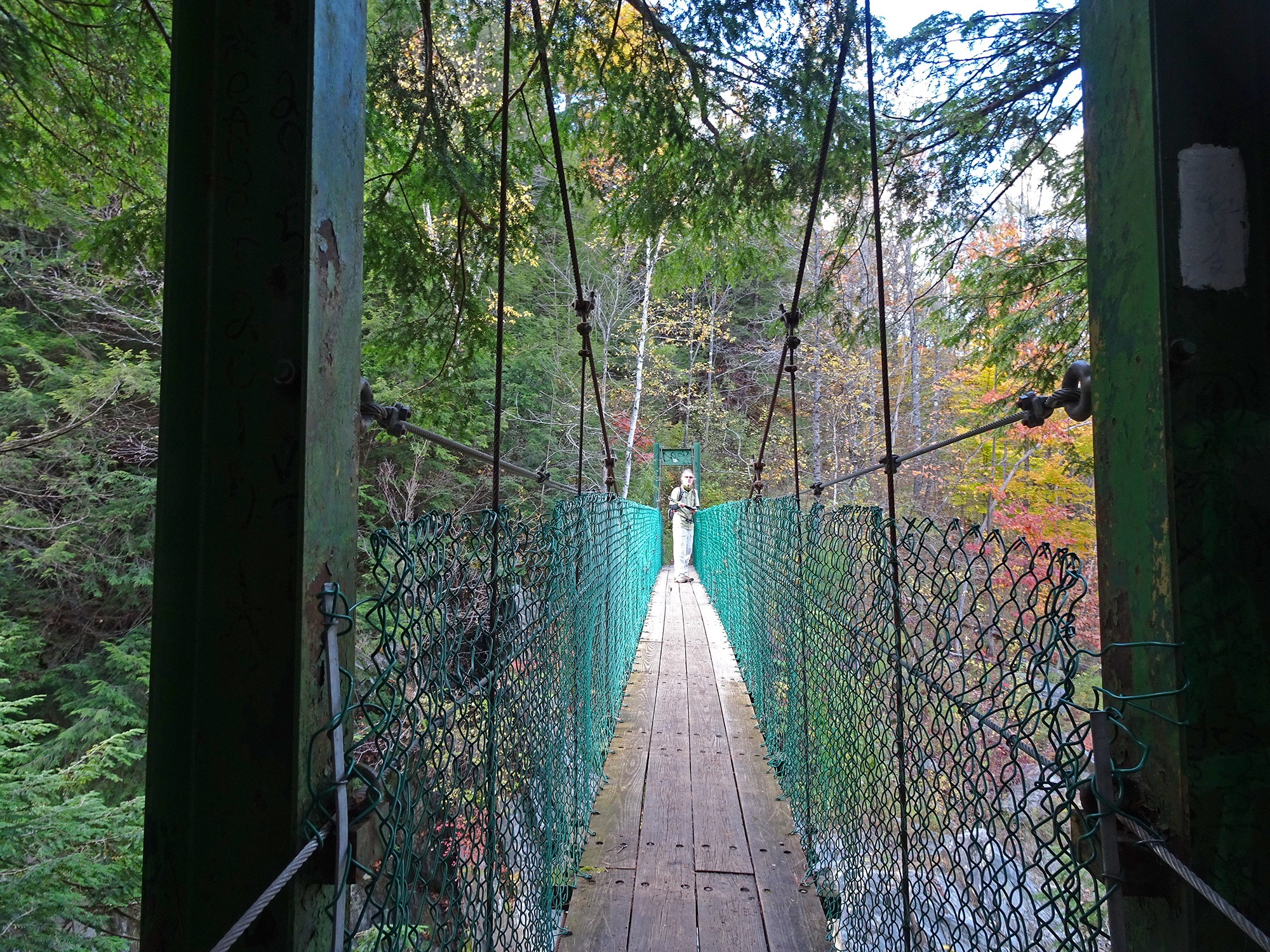
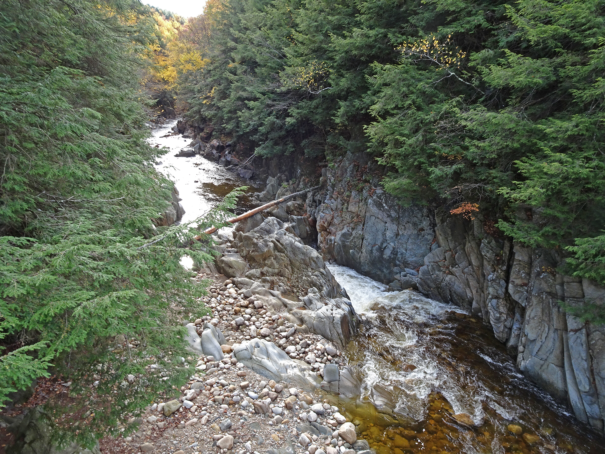
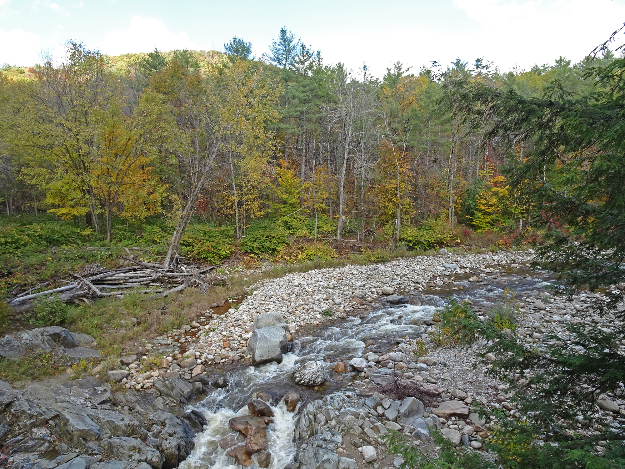
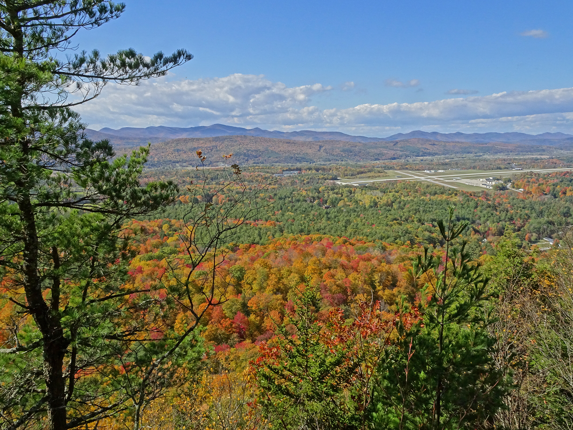
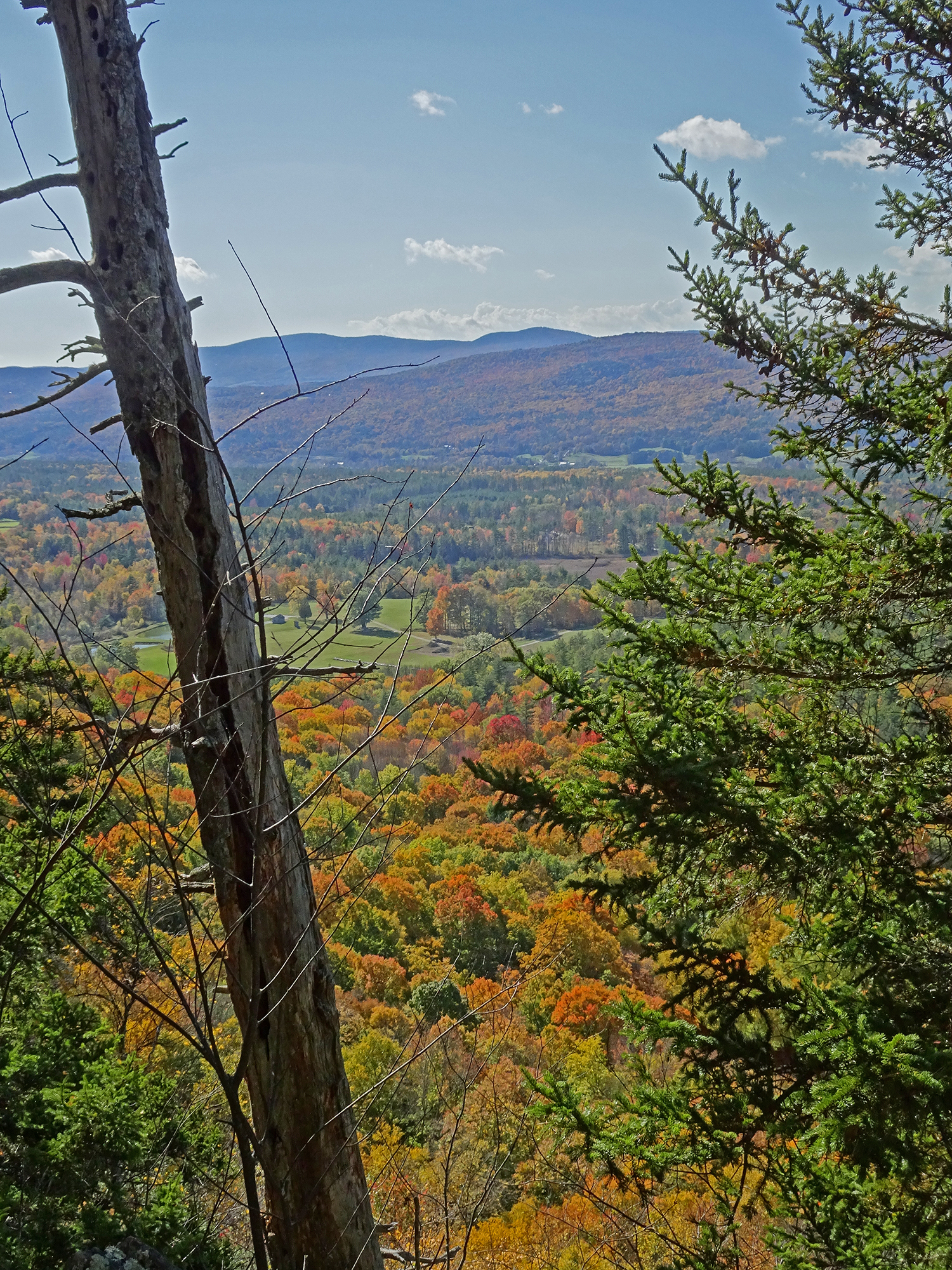
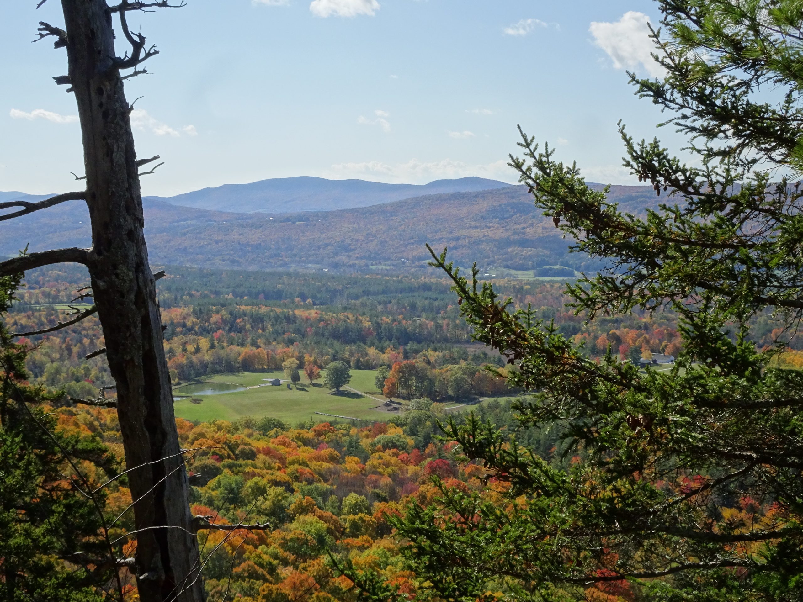
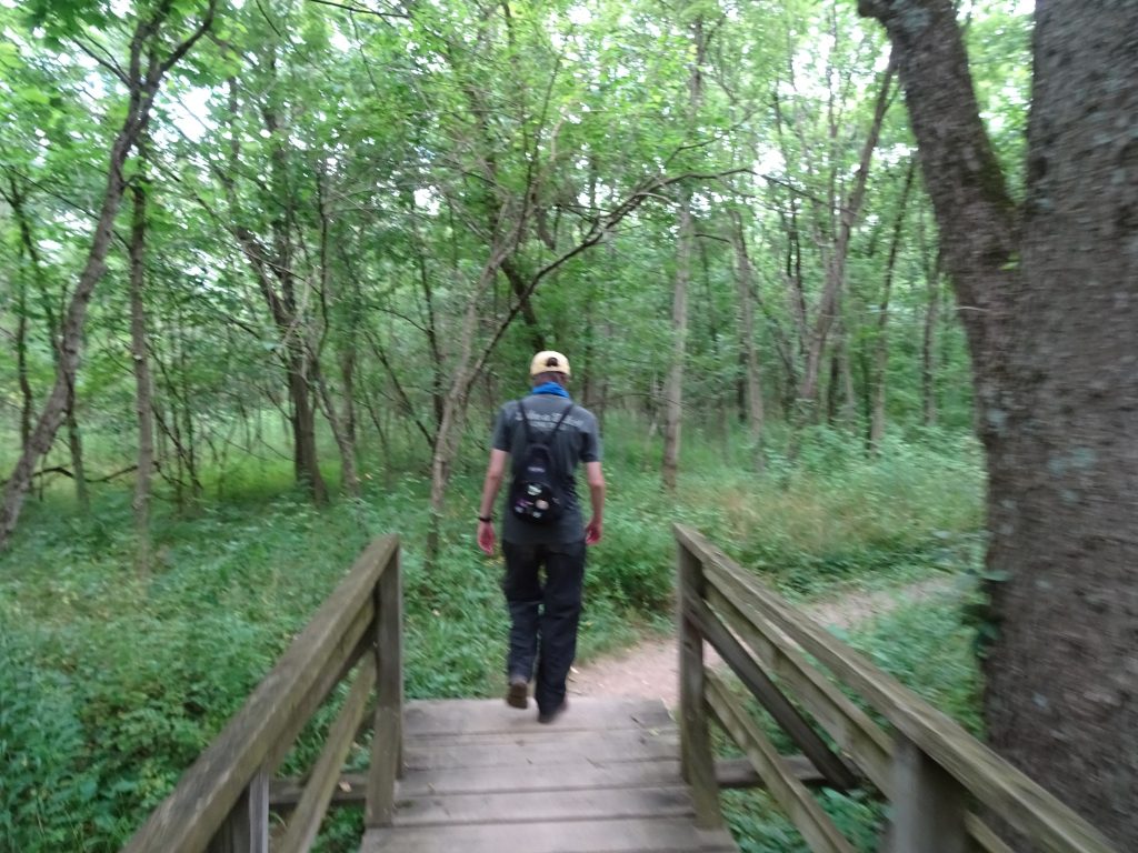
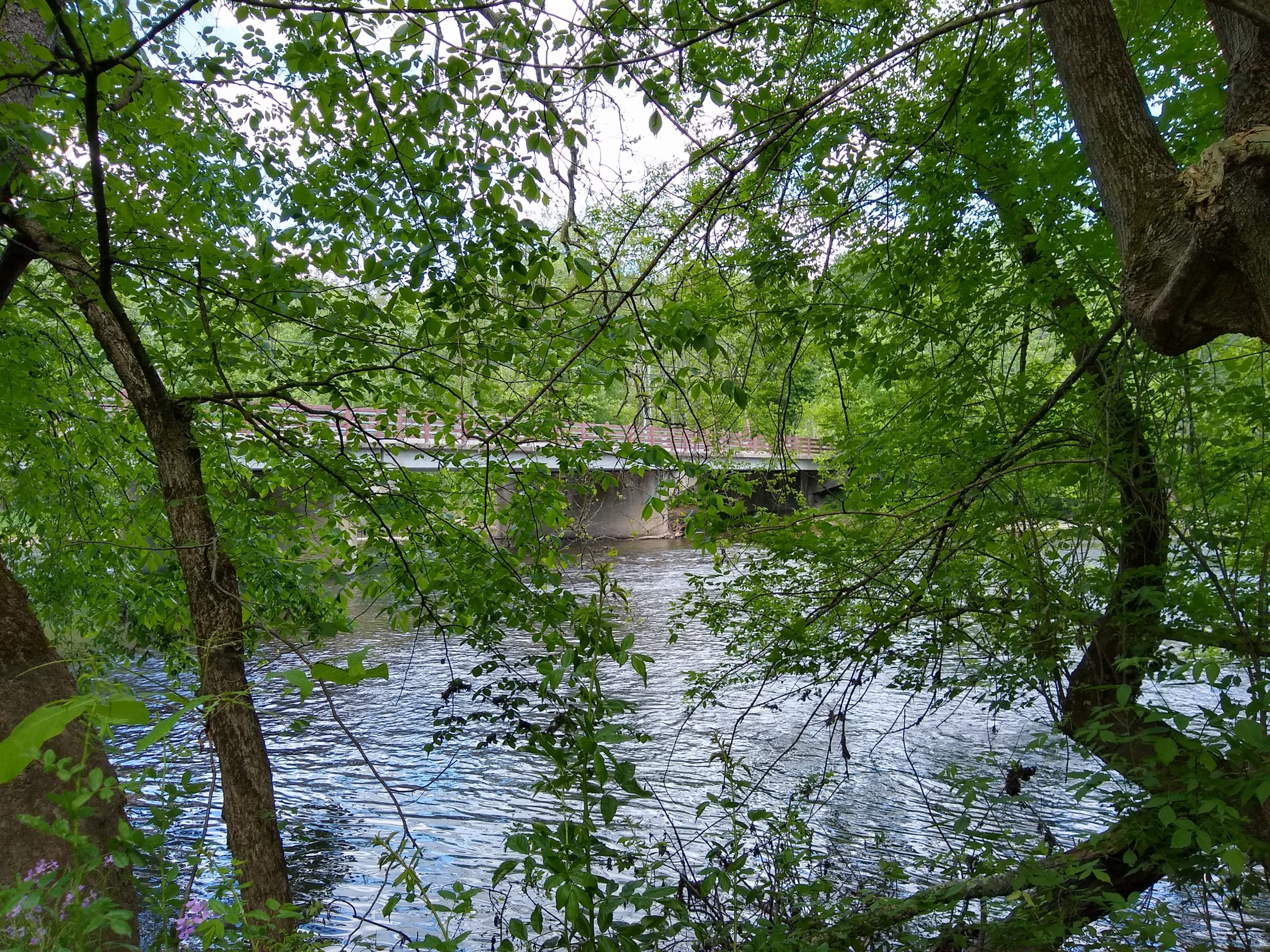
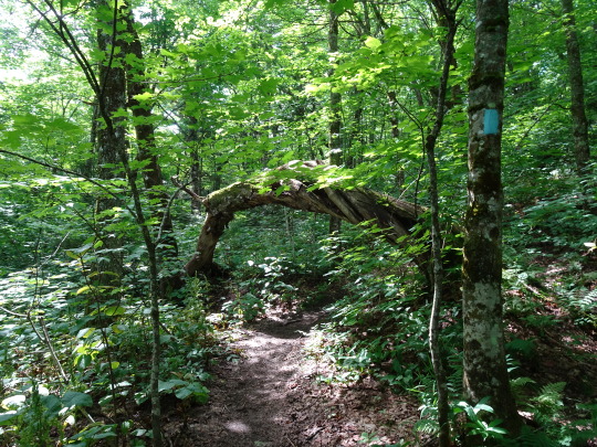
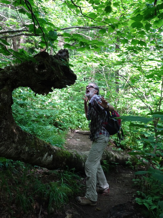
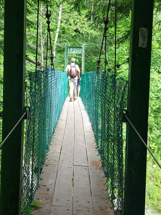
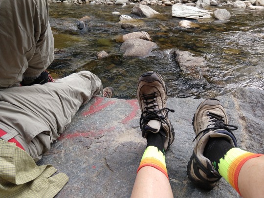
We found the Tucker Johnson Shelter at the cold halfway point of a recent hike on the Appalachian/Long Trail south of Pico Mountain, just when we needed it. We had hiked a mile and a half up the mountain, to a point where the wind was becoming quite biting on a crisp November afternoon, so we were happy to take refuge in this three-sided building.

The Tucker Johnson Shelter

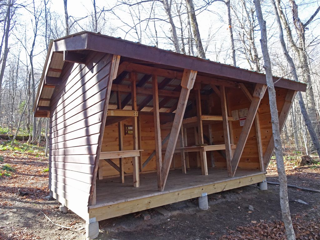
The trail guide that I use said that a shelter was going to be built sometime “after 2012,” and the building was a welcome sight. The shelter looked brand new, its blond wood barely weathered.

I did a little digging and discovered that the shelter was constructed by Green Mountain Club volunteers in fall 2018. (Read the story here.)

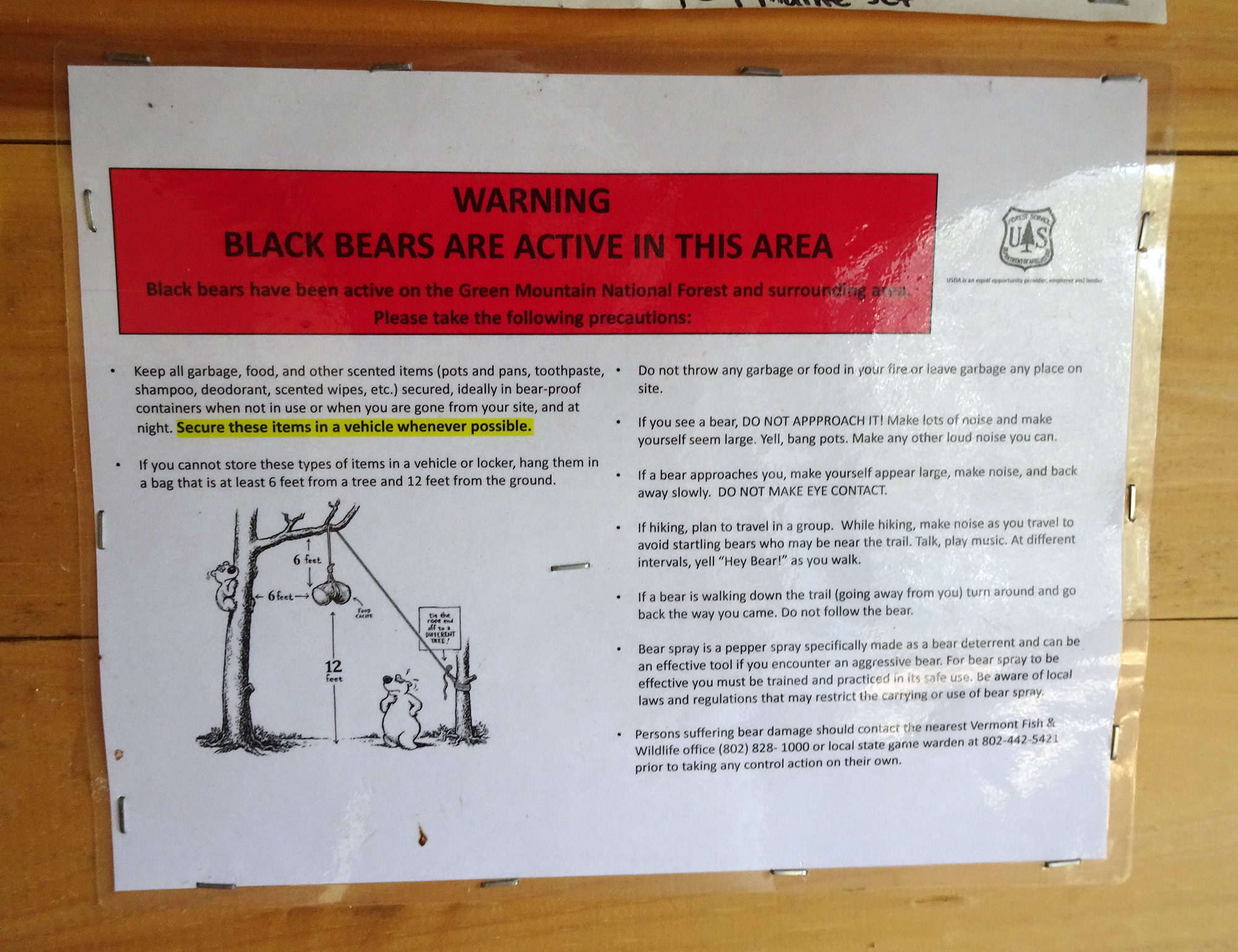
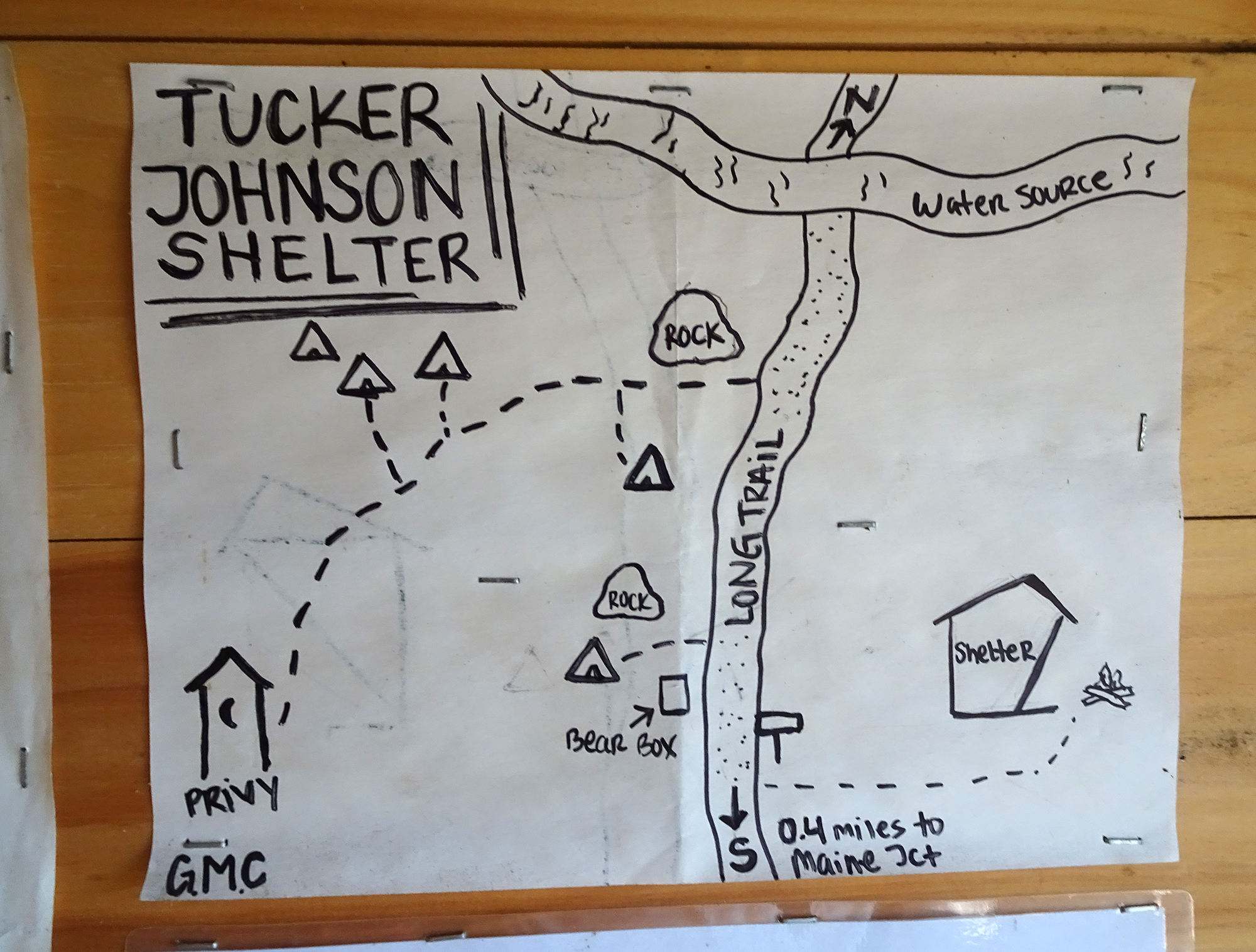
The shelter was open on one side, and had four bunk beds. A sign on the wall instructed hikers on how to hang their food so they wouldn’t attract unwelcome bear scavengers. There was even a privy (outdoor toilet) nearby, the lap of luxury for through-hikers.
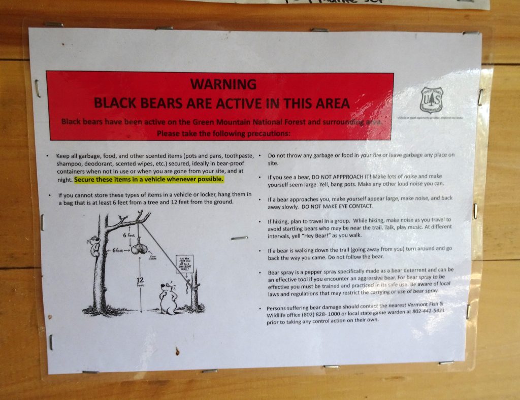
I imagine a night of shelter can be a welcome respite in the middle of a long hike.

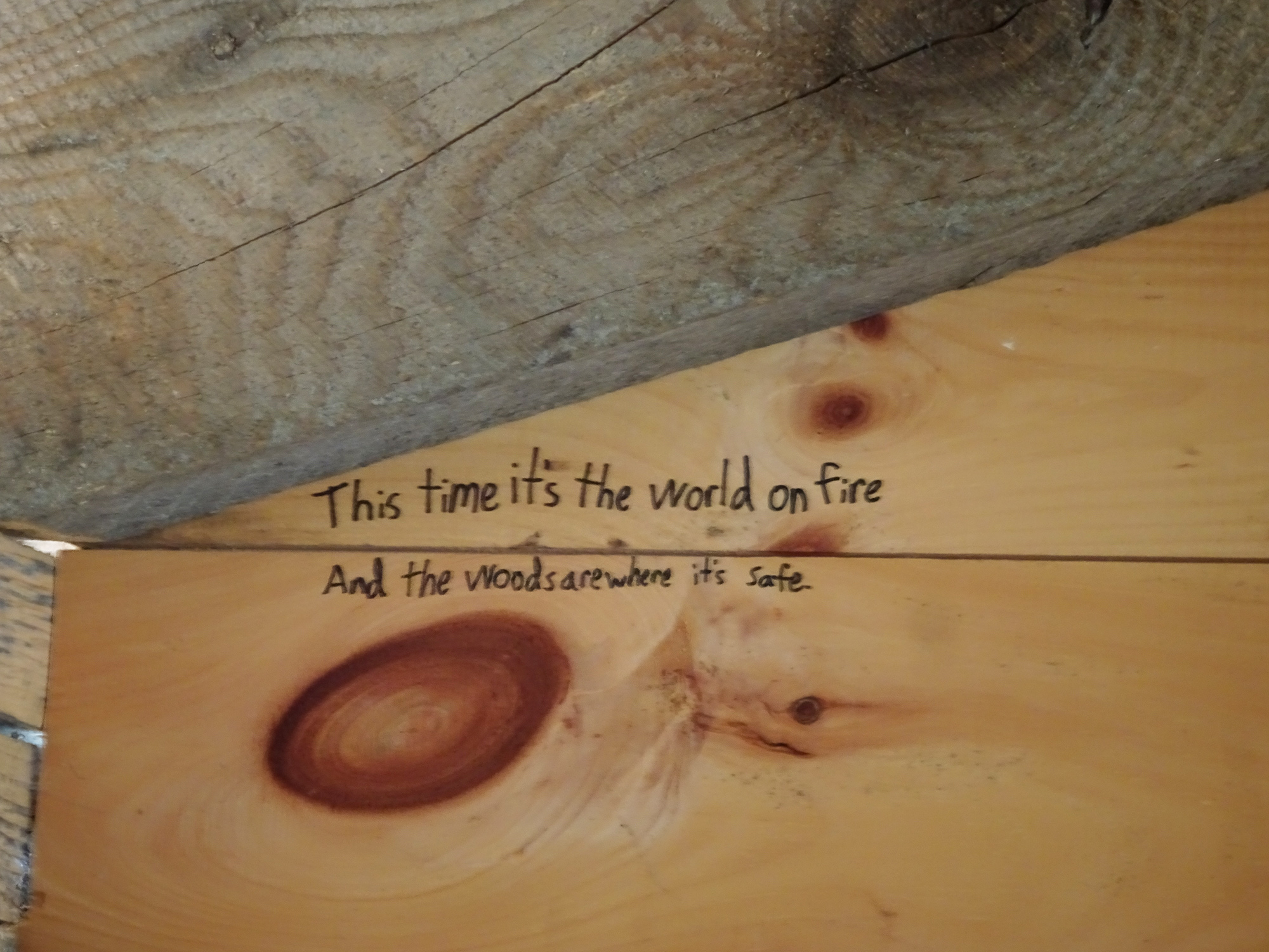
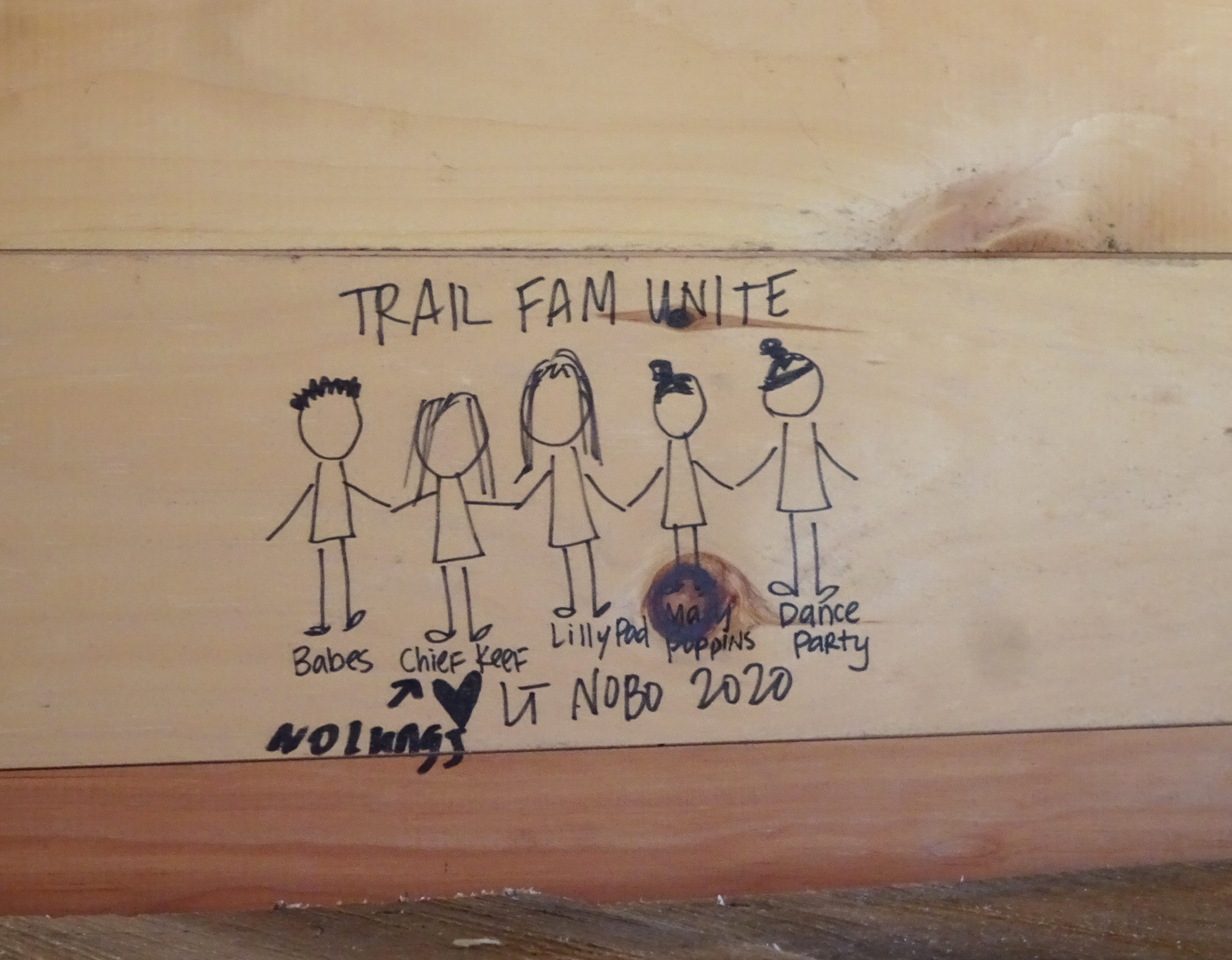
Graffiti Storytelling

There was very little graffiti on the inside, attesting to the youth of the structure, but we enjoyed the stories the etchings told.

Trail Book Storytelling

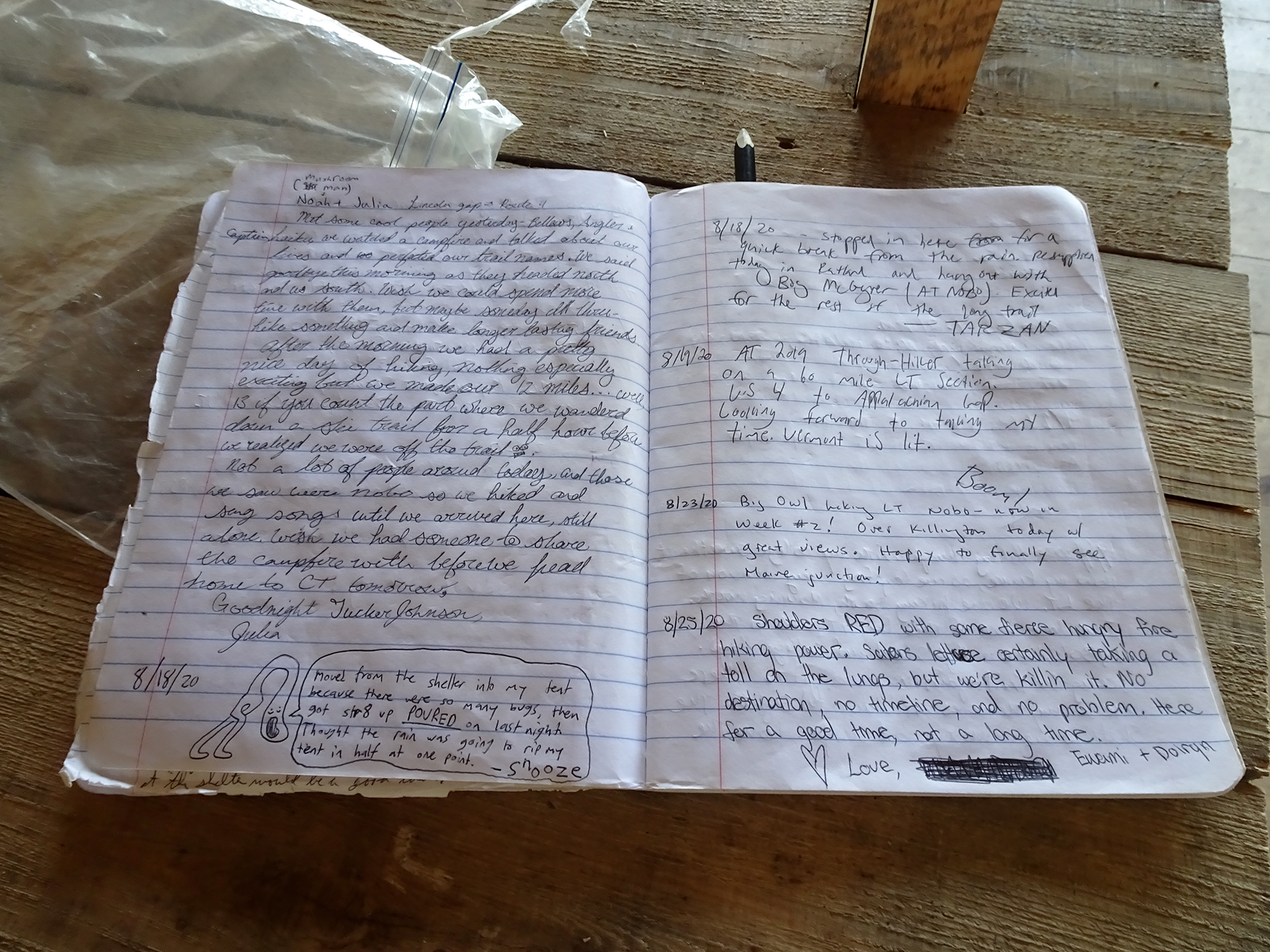
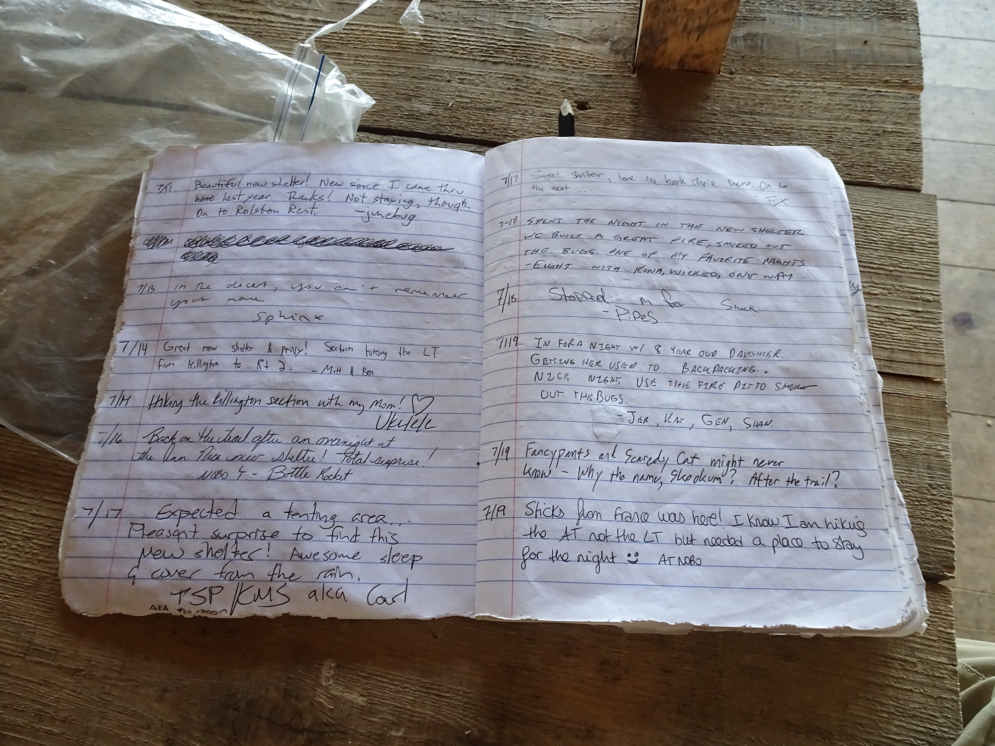
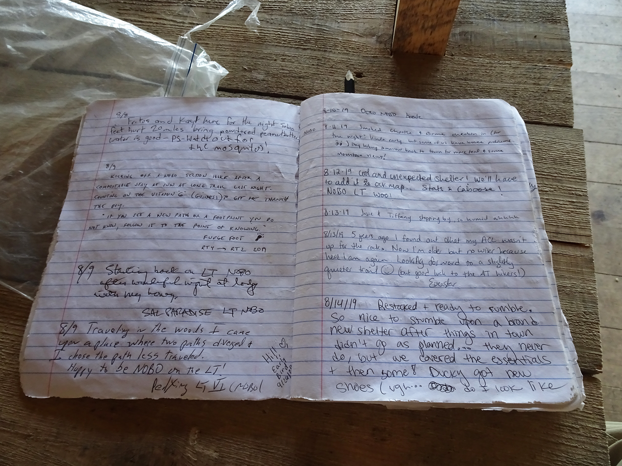
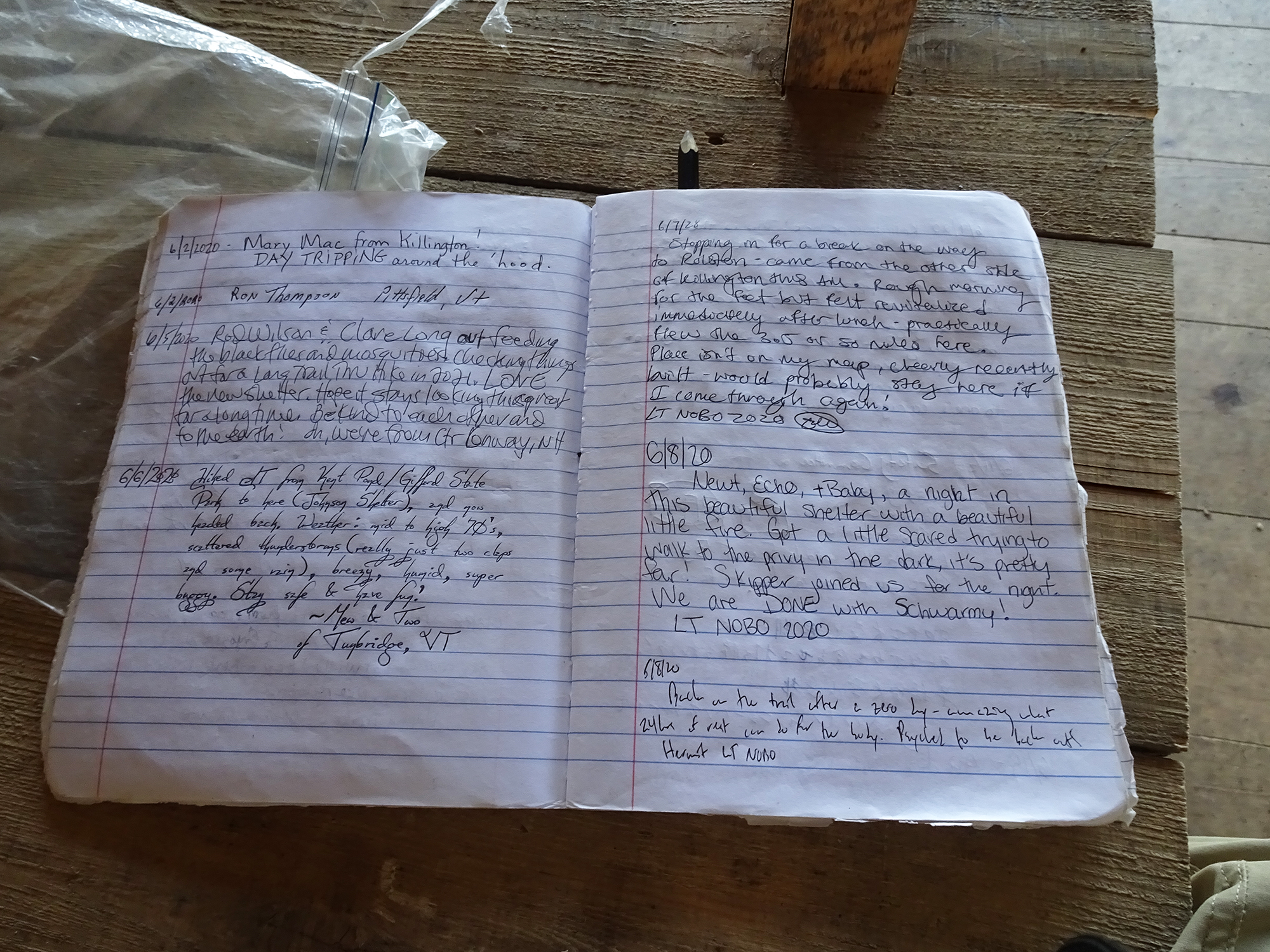
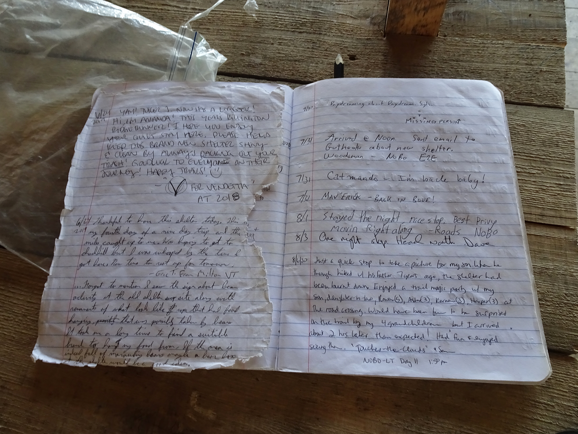
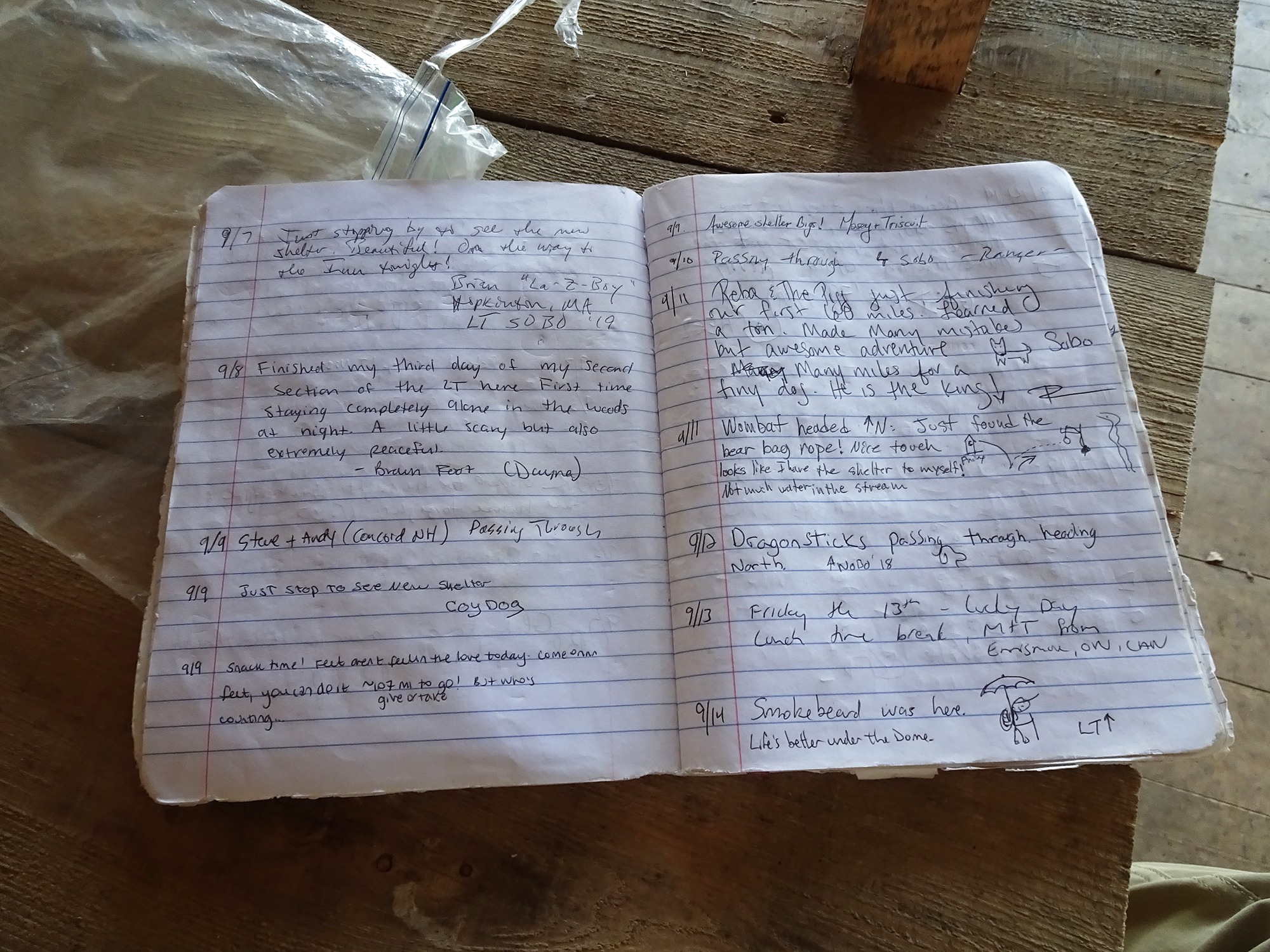
Inside, we found a sign-in book inside a sealed plastic bag, with lots of travelers’ comments as they stopped for shelter along the trail.

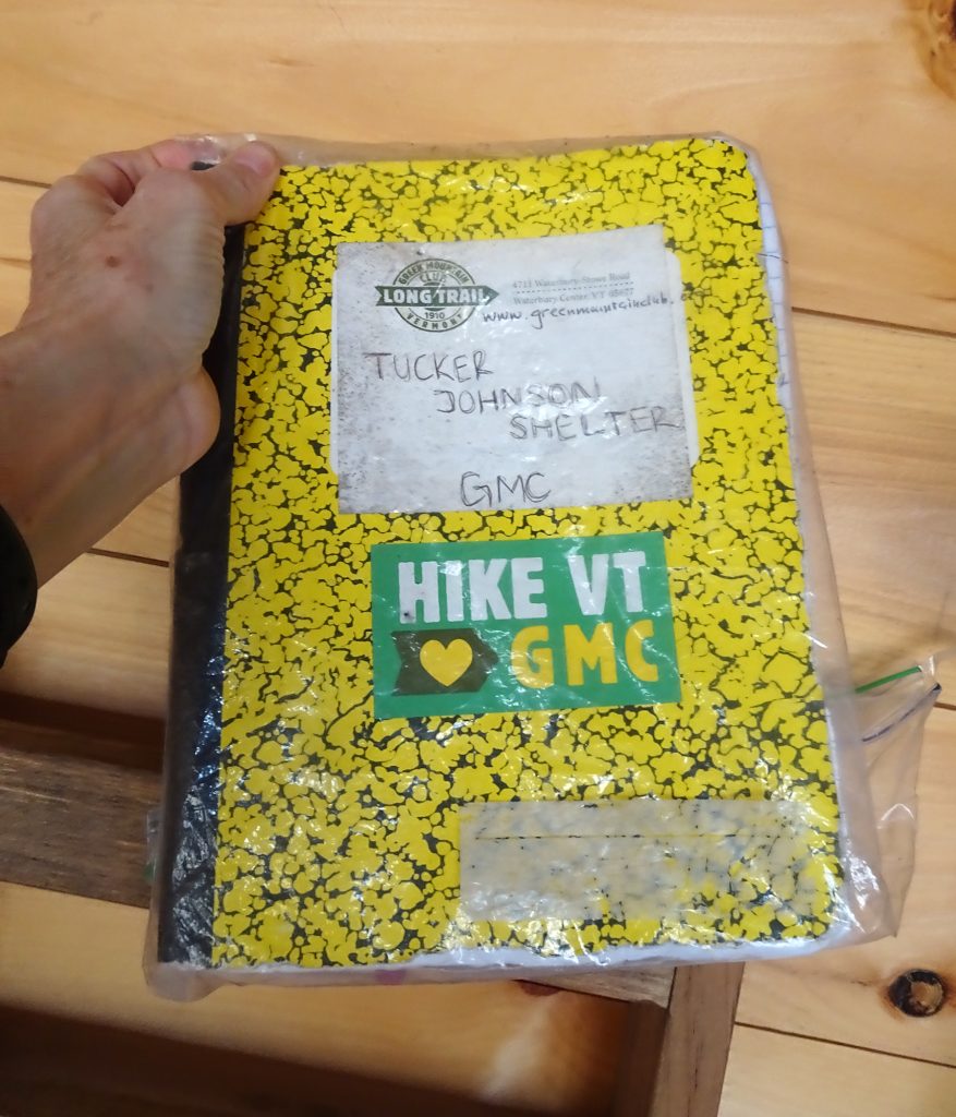
I enjoyed flipping through the book, where travelers with nicknames like V for Vendetta, Missing Person, andEarly Bird shared snippets of their lives on the trail. The first entry was in July 2109. The last was the one I left, signed by “The Hammster,” my new trail name.

Here are a few of the entries. If you click on individual pictures, they will expand so that you can read them better.

Choose Love

The last thing I noticed was a heart-shaped, painted stone that someone had left in the shelter. Choose love, my friends.

Fall Foliage in Clarendon Gorge

Yesterday we hiked on the Appalachian Trail, heading south at the Clarendon Gorge South trailhead. We hiked this during the summer, and after noticing while running errands in Rutland that this valley was still at its fall foliage peak, we decided to head over and see how it looked in full autumn regalia.

The Suspension Bridge

This hike is interesting from the very first quarter-mile because you cross the Bob Brugmann Suspension Bridge, which was built in the late 1970s and named for a close hiking pal of my friend Welles Lobb who was swept to his death while crossing the gorge as a teen. From the middle of this shaky bridge, you have outstanding views in both directions of the Clarendon Gorge Falls, a popular day trip for local residents. At the end of the hike we passed some through-hikers bathing in the low waters of the gorge (but respectfully did not take any pictures of their bare asses).

Bob Brugmann Suspension Bridge

The Trail

Turn right immediately after crossing the bridge and you begin the steep ascent onto the Appalachian/Long Trail. Warning: This trail is never not steep. This is not a hike for the faint of heart. It is difficult and rocky in parts, and extremely slippery. My new hiking poles came in handy, and even Bob pulled out his for the descent. But it is worth it for the rugged beauty of the forest you pass through.

The Views

We were rewarded with outstanding views from the two vistas along the ridge, which look west through a valley that hosts Rutland Regional Airport below. The day was so clear that we could easily see the orange-brushed Adirondacks in the distance.

The Planes! The Planes!

Our timing in reaching the vistas was perfect because we saw two planes taking off — one a puddle jumper and one a jet, probably filled with New Yorkers going home after the long Indigenous Peoples Day weekend.

We heartily recommend this hike to anyone visiting southern Vermont!

Hiking the Appalachian Trail

OK, so we can’t go to movies. We can’t go to restaurants. We can’t explore new cities, make new friends, photograph churches, practice Spanish, soak up the culture. But we can get outside and explore nature!

So while we have been living in Grandma’s condo in Mechanicsburg, PA, this Spring and summer, we at Messy Suitcase have been spending a lot of time on foot exploring the Appalachian Trail here. You can access an interactive map to get info about the trail in your region, if you live in the northeast United States.

Here are a few facts about the AT:

Total Length: 2,190 Miles

Number of States the ATTraverses: 14

Approximate Gain/Loss in Elevation: 464,500 Feet

Visitors Each Year: 3 Million

Here in Cumberland County, the trail has its lowest, flattest stretches, but there are still some hills to climb. Much of it runs along the Conodoguinet Creek.

How to Hike Safely in the Age of COVID-19

We have several rules we follow when hiking. We wear lightweight gators around our necks to pull up for use as masks should we pass anyone. We start early (to avoid heat) or hike during off-peak times because NO ONE else bothers to mask. We move well off the trail to let people pass. We wear long pants because of ticks. We are gluttons when we pass wild black raspberry or wild raspberry patches.

Hiking on Vermont’s Long Trail

Did you know the Appalachian Trail was inspired by Vermont’s Long Trail? Beto and I discovered this after a couple of recent hikes on the Long Trail, the oldest long-distance hiking trail in the United States. Known as Vermont’s “footpath in the wilderness,” the 272-mile Long Trail runs from Massachusetts to Canada, with 166 more miles of side trails.

Built by the Green Mountain Club between 1910 and 1930, it follows the main ridge of the Green Mountains and crosses Vermont’s highest peaks. The Appalachian Trail coincides with the Long Trail for 100 miles in the southern third of Vermont, including around Ludlow, where we are staying. It is not for the faint. Crossing high peaks means a lot of up and down. And we have discovered it can be tricky.

 
Long Trail Hike 1
Last weekend we drove north to Killington and got onto the trail across the street from the appropriately named Inn at Long Trail. We hiked three hilly, strenuous miles through amazingly lush, green woodlands – especially coming from dry, high desert ecosystems in the mountains of Colorado and Mexico! As it was our first hike since arriving in Vermont, we turned around after a mile and a half, just .6 miles from the peak of Pico Mountain, which we will attempt to scale another time.


Long Trail Hike 2
This morning we embarked on the combined AT/LT along Route 103 between Mount Holly and Clarendon. At the beginning, we had to cross a beautiful, shaky suspension bridge over a glorious gorge, and I remembered bringing my kids here for a walk about 15 years ago, and they were terrified.

 
The Long Trail is marked by two-by-six-inch white blazes (side trails are blazed in blue), but when we got into the woods on the other side, we couldn’t find any. We followed the unmarked trail along a wide, rocky creek, then turned right to follow a second promising path straight up the mountain. But there were still no markers, and eventually we encountered a US Land Boundary Marker, and the trail petered off into nothingness. It was a weird, vulnerable feeling to be standing there in the middle of the woods with no trails in any direction.
So we went back down the hill and continued the creekside hike, passing several camping groups – one a young family with a small tent and two smaller children in swimsuits getting ready for an icy swim in the creek, and the other a group of adults with two large tents cooking over a big breakfast fire. Again, no markers.
Idyllic Discovery
When the trail suddenly ended, we saw a large flat rock at the edge of the creek with a red heart painted on it, and took a break. That break turned into an hour-long siesta during which we just let go and enjoyed being in nature. Bo laid back and snoozed. It was warm but cloudy, and the cold water kept it refreshing. I just drank in the bright green leaves on the trees across the creek, the trickle of the water, the patterns on the rocks, and the play of light on the surface of the water. Several small planes flew overhead (we were not far from Rutland Airport) and we listened to the rumble of a train approaching, passing and departing, just beyond visibility through the trees.

 
We sat quietly, talked about life and the kids, and just breathed. It was idyllic, and we will definitely return with a picnic.
On the way back, Beto found the turnoff to the Long Trail not far from the suspension bridge, so we will be back next week. It starts straight up, so I anticipate a challenging hike.
Learn more about the Long Trail here.
 
By Lisa Hamm-Greenawalt
Social media & sharing icons powered by UltimatelySocial
Facebook
Instagram
YouTube
Twitter
Pinterest