Walking around downtown Cancun, Mexico, we came upon a ballfield on which a group of men and boys with painted bodies and leather loincloths was playing a very odd game of ball. They hit a heavy rubber ball by bumping it with their hips.
We learned from a knowledgeable spectator that the game was Ulama, a descendant of a 3,500-year-old pre-Colombian game called Ullamaliztli that was popular among the Mayan and Aztec people. Today, Ulama is only practiced in four small towns of the state of Sinaloa in Mexico. But it’s making a comeback!
On our trip to the Mayan archaeological site of Chichen Itza, Mexico, we took a side trip to a deep Mexican cenote (pronounced She-NOH-tay) called X-Cajum (I have no idea how to pronounce that).
A cenote is a natural sinkhole resulting from the collapse of limestone bedrock at the ceiling of a cave, that exposes groundwater. For Mexico’s Mayan culture, cenotes were a symbol of duality, since they represented life and death. They were also a water source.
For travelers today, they are a unique swimming experience, providing astounding views, lovely snorkeling, and a great way to cool off.
We visited Cenote X-Cajum, which is very near Chichen Itza and is often bundled as part of the tour to the Mayan ruins.
The archaeological site Chichén Itzá in the Yucatan Peninsula is one of the most visited locations in Mexico, so of course we climbed aboard a bus during our Cancún visit and headed there for a day.
Rich in history and the center of pilgrimage for the ancient Maya civilization for over 1,000 years, this pyramid must be seen to be believed. Chichen Itza was classified as one of the New Seven Wonders of the World and in 1988 was enlisted as a UNESCO World Heritage Site. Lisa actually climbed up the steep steps to the top when she visited in the late 80s, but tourists are no longer allowed to get that close. Good thing, too. It’s steep!
On the way back to Cancun, we enjoyed a short visit to the magical city of Valladolid (pronounced Vah-YAH-Doh-Leed), which had a lively town plaza featuring Mayan dance, sport, and music, as well as a beautiful cathedral, and earsplitting birds!
No trip to Mexico’s Yucatan Peninsula is complete without a boat ride over to Isla Mujeres, aka the Isle of Women (pronounced ISS-lah Moo-HAIR-es).
Just a seven-mile boat ride east of the mainland across breathtaking turquoise sea, Isla Mujeres is known for its lovely beaches, world-class fishing, and spectacular coral reefs. There is also a lighthouse, the remains of a Mayan temple, and a sanctuary for sea turtles. We spent a day exploring the funky little village, and encountered a parade, snorkeled through schools of colorful fish on a tour with the marvelous Squalo Adventures, and discovered the MUSA, a fascinating underwater art museum.
We also had the worst pina coladas ever. (But everything else, we can recommend!)
We had a last-minute opportunity to visit Cancun, Mexico. Join us for a quick overview of this popular tourist zone! And watch for future videos of the adventures we had there.
We traveled deep into the lush mountains of Puerto Rico to Toro Verde to take on the Monster, the longest zipline in America!
Come fly through the air with us on seven exciting ziplines, then get vertical and fly headfirst up to 95 miles an hour on the Monster (8,300 feet) and the Beast (4,745 feet)! Leave your fear of flying behind and join the birds at 380 meters above the ground.
Toro Verde also offers other activities, including bicycling on a zipline and several climbing walls, and several restaurants with awesome views of the mountains and the screaming zipliners.. Advance tickets are required.
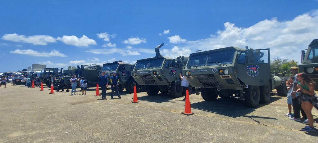
We tried to go inside a Hurricane Hunter airplane! Alas, the rest of western Puerto Rico did, too.
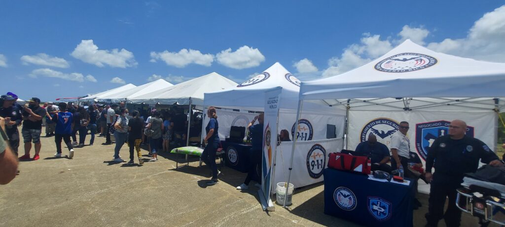
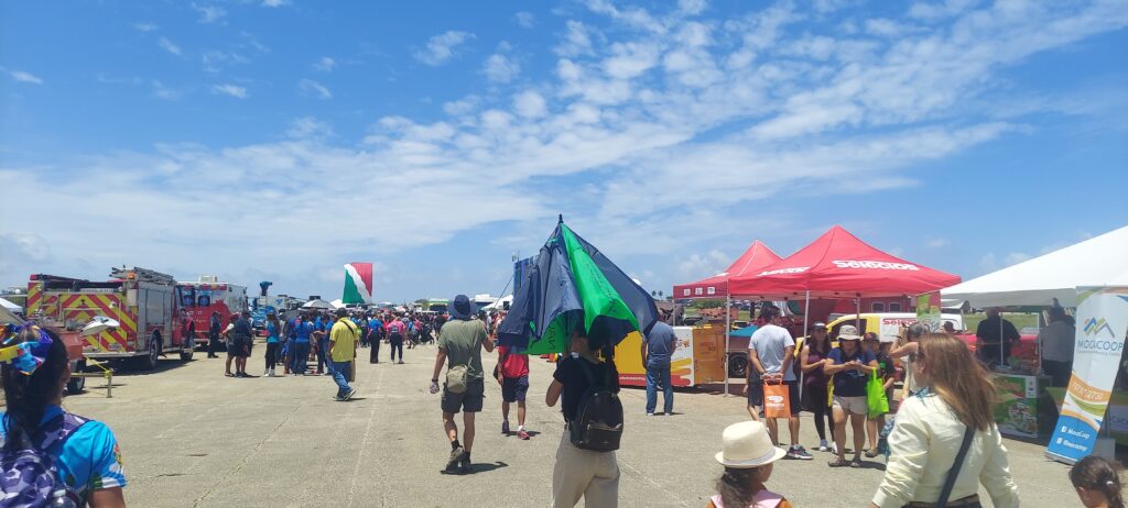
NOAA (the National Oceanic and Atmospheric Administration) and the U.S. Air Force Reserve hosted a series of events this spring in preparation for hurricane season in Mexico and the Caribbean, to help people prepare for upcoming storms. They brought their big Hurricane Hunter plane to Aguadilla, about an hour from our Cabo Rojo home, and we headed north excited by the prospect of seeing the inside of the Air Force Reserve Command’s WC-130J “Hurricane Hunter” aircraft and learning how scientists collect data about hurricanes.
What we got was something completely different, a street-fair atmosphere of rescue workers, local communities, and emergency preparedness info — and an hours-long line to get inside the Hurricane Hunter aircraft. We decided to take a pass.
Beto with his buddies, La Policia
The National Hurricane Center held the event so that hurricane specialists could educate residents of vulnerable communities and discuss hurricane preparedness, resilience, and how they can become “weather-ready.”
The Atlantic Hurricane Season runs from June through November. The areas covered include the Atlantic Ocean, Gulf of Mexico, and the Caribbean Sea.
Here is some valuable information from the NOAA website:
“During hurricanes, military air crews fly state-of-the-art WC-130J aircraft directly into the core of the storm to gather critical data for forecasting a hurricane’s intensity and landfall. The data are sent in real time via satellite from the aircraft directly to the NHC for analysis and use by hurricane forecasters.
“During the 2022 hurricane season, the 53rd Weather Reconnaissance Squadron flew 109 missions into 13 named storms in the Atlantic and east Pacific basins, including Hurricanes Ian and Nicole in the Atlantic and Hurricanes Agatha, Kay, Orlene, and Roslyn in the east Pacific.
“The NOAA Hurricane Hunters, stationed at the Aircraft Operations Center in Lakeland, Florida, also fly missions into tropical cyclones to gather data to support storm forecasts and research. Their Lockheed WP-3D Orion and Gulfstream IV-SP aircraft are piloted by NOAA Commissioned Corps officers and crewed by NOAA meteorologists, technicians, and researchers.”
We never got inside the aircraft, but you can take a virtual tour here.
El Capitolio, the capitol building of Puerto Rico, greets you as you drive into Old San Juan. It’s a century-old neoclassical structure with a commanding dome situated on a hilltop overlooking the Atlantic Ocean. Bob decided it was time to take a tour inside!
For Puerto Ricans, El Capitolio de Puerto Rico stands as a powerful symbol of self-government. This video is packed with history, info, and photos, as well as a tour of the many fascinating monuments near the capitol building.
We hopped on a double-decker bus for a tour of Bath, England, a World Heritage city about an hour and a half west of London with stunning golden Georgian architecture, historic Roman Baths, an incredible Abbey, the homes of iconic authors Jane Austen and Mary Shelley, and too much more to recount. Then we hopped off and strolled around the historic city centre, finishing with some excellent craft beer. Join us!
INFO
Here are links to many places mentioned in the video:
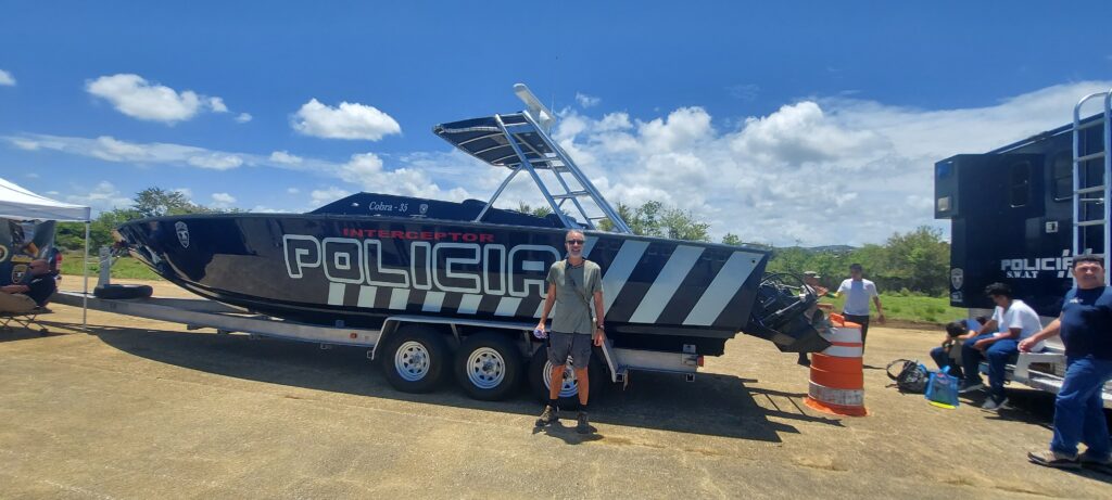
There is so much to do at Combate (pronounced Come-BAH-tay) Beach in Cabo Rojo, Puerto Rico! Beto prefers to relax in his Tommy Bahama beach chair with its cooler and cupholder for his frozen Pitorro rum drink, doom-scrolling on his smartphone or reading a book on military history while watching the pelicans fish in the Caribbean Sea and la Policía zip around in their black speedboat chasing nautical scofflaws.
But Lisa likes to explore, walking down the beach looking for shells and sea glass, or hiking or running in Boquerón State Forest, at the edge of a lagoon that attracts a lot of birds, including unique migratory birds. The hiking/biking trail that meanders through the dry forest by the lagoon stretches 7 miles south to the Salt Flats.