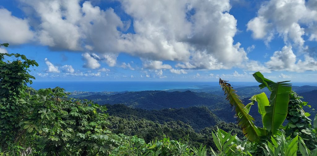
When we gaze south from the outdoor hallway of our condo in Luquillo, Puerto Rico, we behold El Yunque, Puerto Rico’s magnificent rain forest. Usually, its imposing peaks are covered by clouds. Sometimes they are enveloped in gray, and we can watch those storms move across the valley toward us before soaking our parking lot. Days when the clouds part and the peaks reveal their lushness are rare. The clouds dance with the setting sun come evening.
But we were lucky this week. Monday dawned sunny and glorious, with no rain in the forecast, so we pulled on our hiking shoes, water bottles, and cameras and hit the road right after breakfast.
El Yunque (the name literally means The Anvil) is the only tropical rain forest in the US National Forest system. At 28,000 acres, with peaks as high as El Toro’s 3,543 feet, it dominates the eastern end of the island of Puerto Rico. Its split personality can be exciting but challenging. Make sure you pack a rain jacket if you visit, and check the weather first!
Long History
El Yunque and the Luquillo Mountains have a long history that includes pre-Columbian cultures, Spanish colonization, gold mining, and timber exploitation, and the eventual construction of roads and facilities to give the public access to this emerald gem. (Learn about the history.)
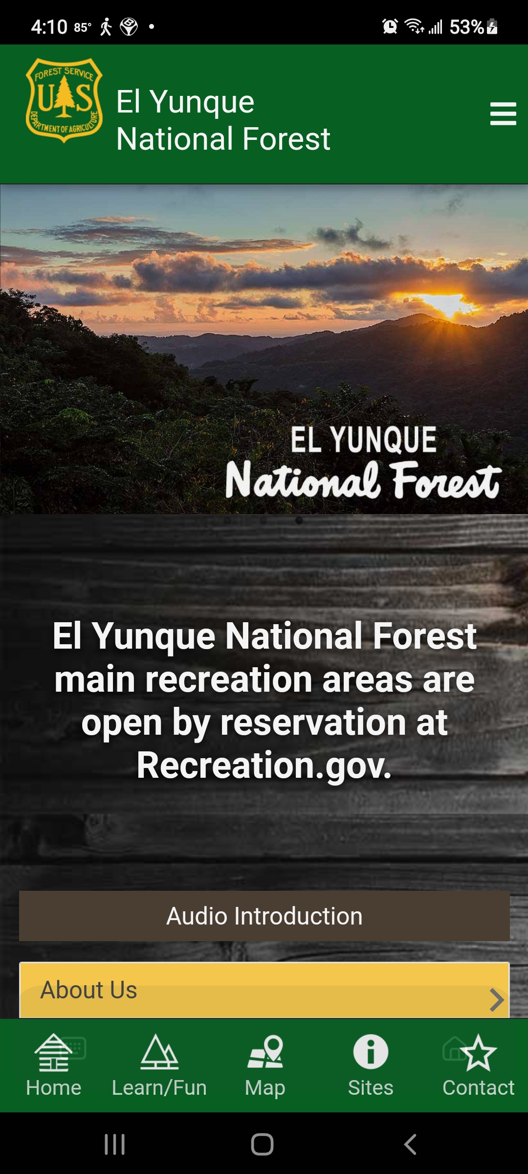
The main El Portal Visitors Center has been closed since it was damaged by Hurricane Maria in 2017, but the US Forest Service has created a really useful app that guided us through the park. (You can find it in the Play store under El Yunque NF.)
The App
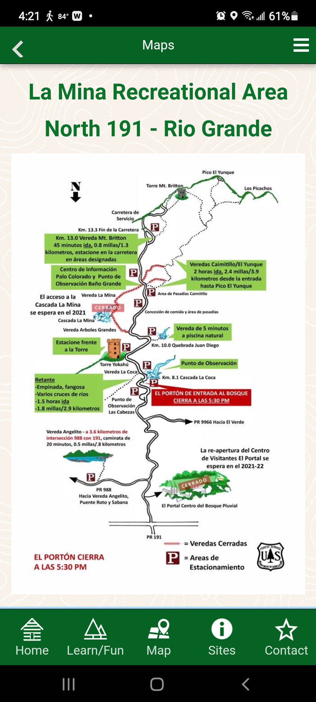
The app offers maps of the main roads into El Yunque, descriptions of trails, kids’ activities, history and so much more. It’s a must-have resource, especially with the Visitors Center temporarily closed.
Day 1
If we had been visiting on a weekend, we would have had to make reservations (for a service fee of $2) online on the US Forest Service website. However, during the quiet months of October and November, weekdays require no reservations.
El Yunque has three entrances. On our first day exploring, under cloudless skies, we chose to casually meander up PR 191, the main entrance for people driving from San Juan, to the highest peak in our rental car, just to get the lay of the land.
As we drove up the road, palm trees leaned in from both sides, creating a lush canopy above us. Occasionally we would pass crashing cascades of water. The sweet chirp of the Puerto Rican tree frogs called coqui tickled our ears.
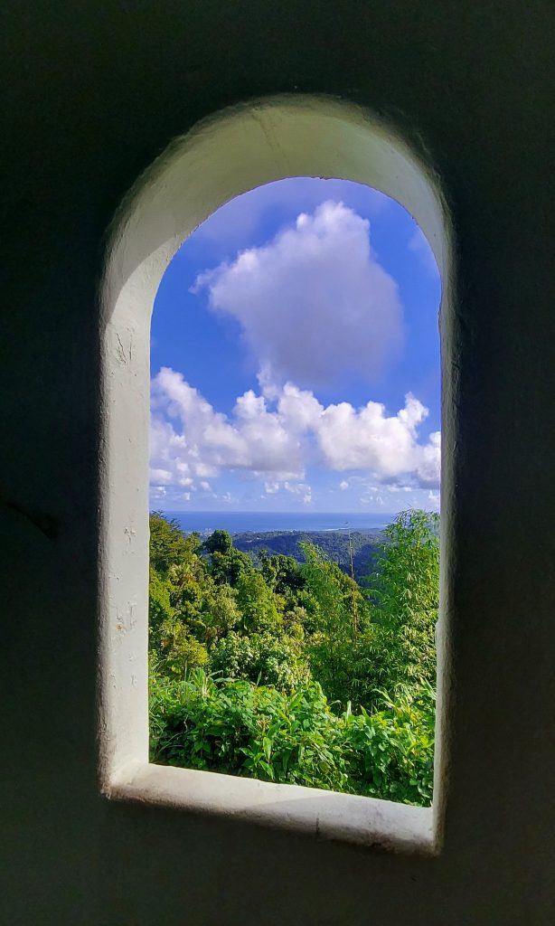
Torre Yokahu
This tower is only a few kilometers up, located right near the road and just a short climb up a spiral staircase. The views of the lush mountainside, Luquillo and the turquoise sea were lovely.
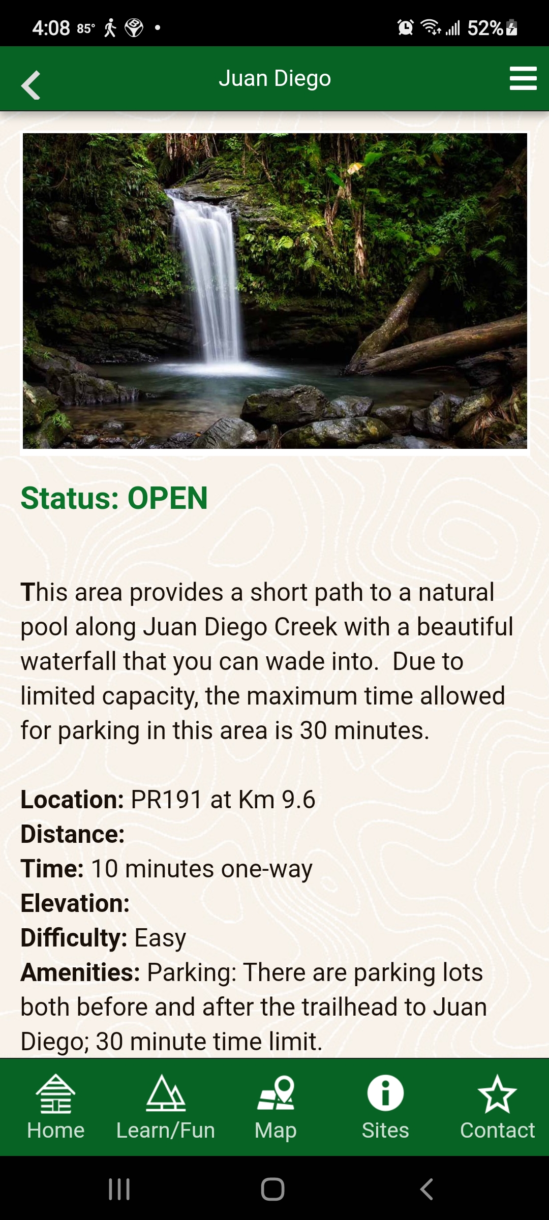
Quebrada Juan Diego
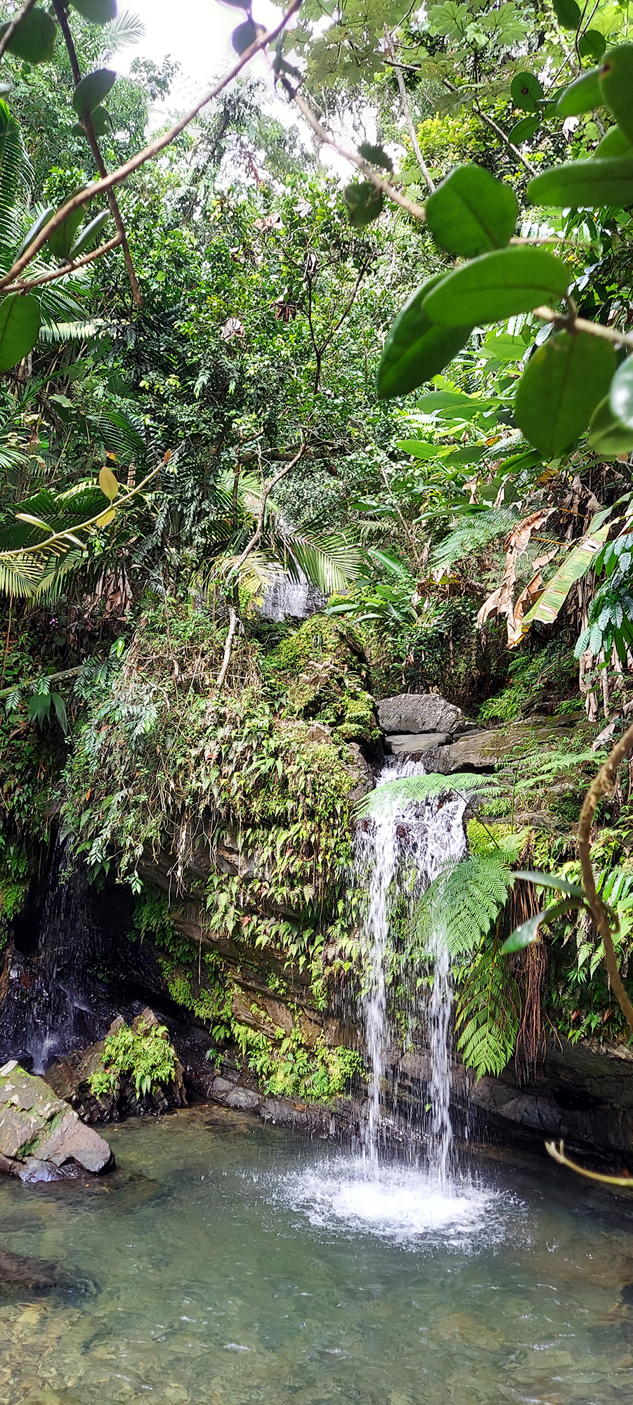
Quebrada Juan Diego (San Diego Creek) took us on a short hike to a thundering waterfall with a clean pool at the base. The bottom was rocky, so we decided to come back on another day with good water shoes to take a dip.
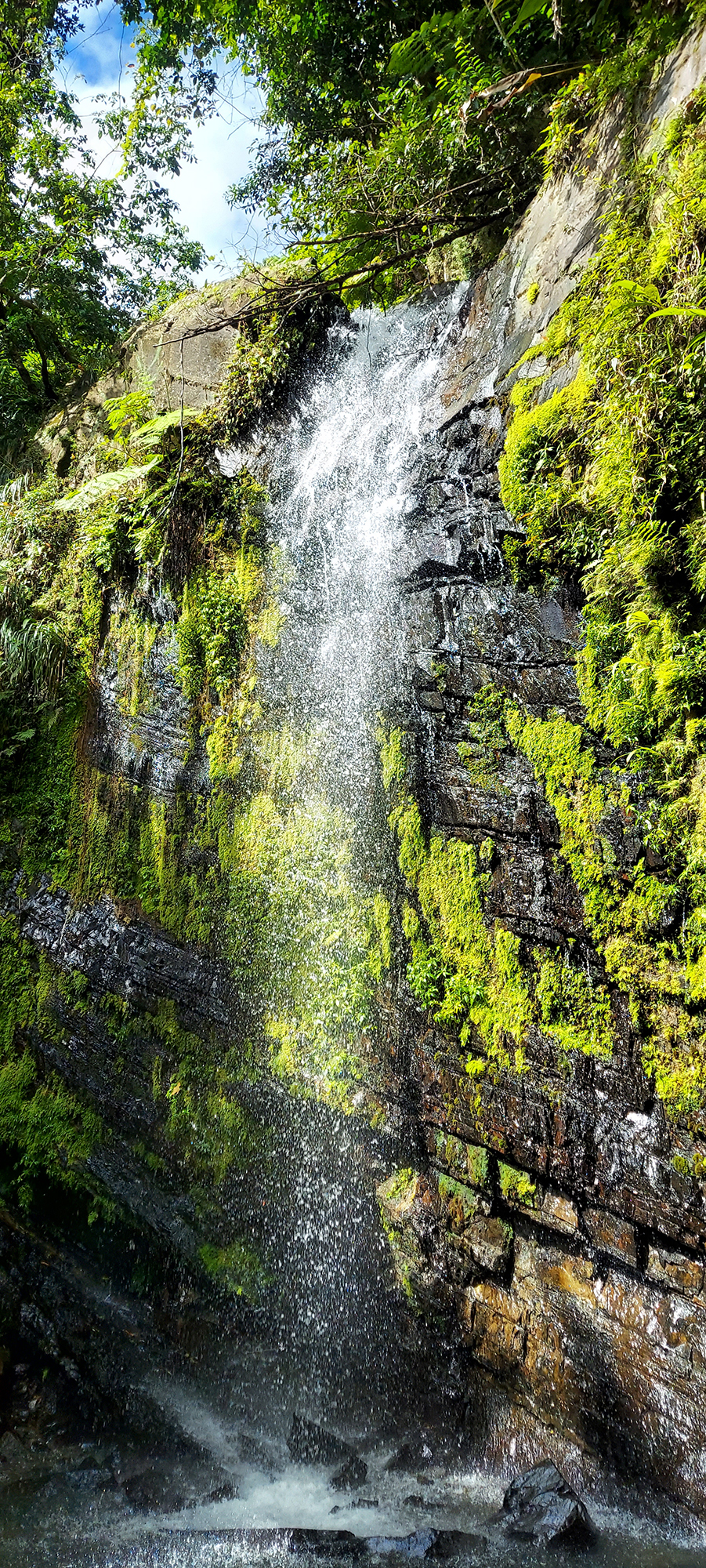
Looking through the trees above, however, we saw a second, higher waterfall. Looking around, we discovered a largely hidden path off to the right, and made our way up a steep, twisting rooted vereda (trail) to an even more dramatic second waterfall. It was amazing!
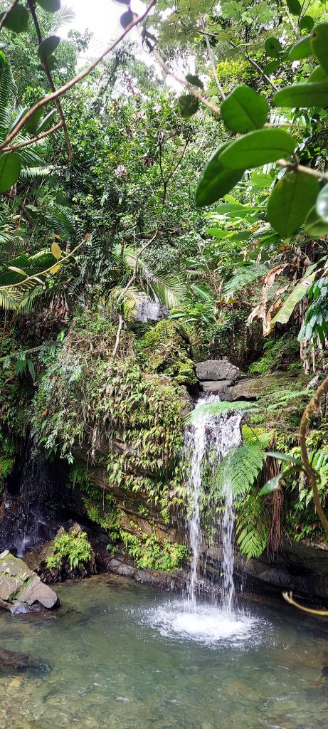
Lower falls 
Higher falls
Torre Mount Britton
At the end of PR 191, we found a trailhead for Mount Britton Tower, a steep route to a mountaintop tower that is less than two miles round-trip. We decided that would be a great second hike, and decided to come back in a couple of days to attempt it.
Sierra Palm Snack Bar
Heading back down the mountain, we discovered a sweet little snack bar called Sierra Palm, named after the forest. It had outdoor seats, as well as a path you could follow down to some concrete picnic structures with fireplaces. We enjoyed smoothies (mine mango and passion fruit, Bob’s pina and coconut) and cheese empanadas with guava paste for dipping. Delicious!
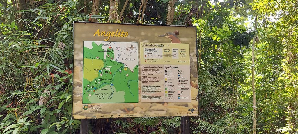
Vereda Angelito
To get a quick first hike in, we took a detour on the way home to Vereda Angelito (Little Angel Trail). The description on the app said it was 20 minutes each way and ended at a pool with a rope swing. It was actually much shorter and easier than we anticipated and only took us ten minutes each way. We found a lot of happy families frolicking in the water on a sunny early afternoon.
Las Tres C (The CCC)
Most of the trails and structures in El Yunque were built in the 1930s by the Civilian Conservation Corps (CCC), one of Bob’s favorite government initiatives ever. Have you heard of the CCC – or, as they say in Puerto Rico, “Las Tres C”?
The CCC was established in 1933 by President Franklin D. Roosevelt as part of his New Deal program, in an effort to put people back to work after the Great Depression, while improving public lands. In El Yunque, it planted forests, built roads and most of El Yunque’s recreational infrastructure. We found a public pool that was built by the CCC, as well as picnic structures (including the ones below the snack bar), trails, and other buildings. Learn all about Las Tres C.
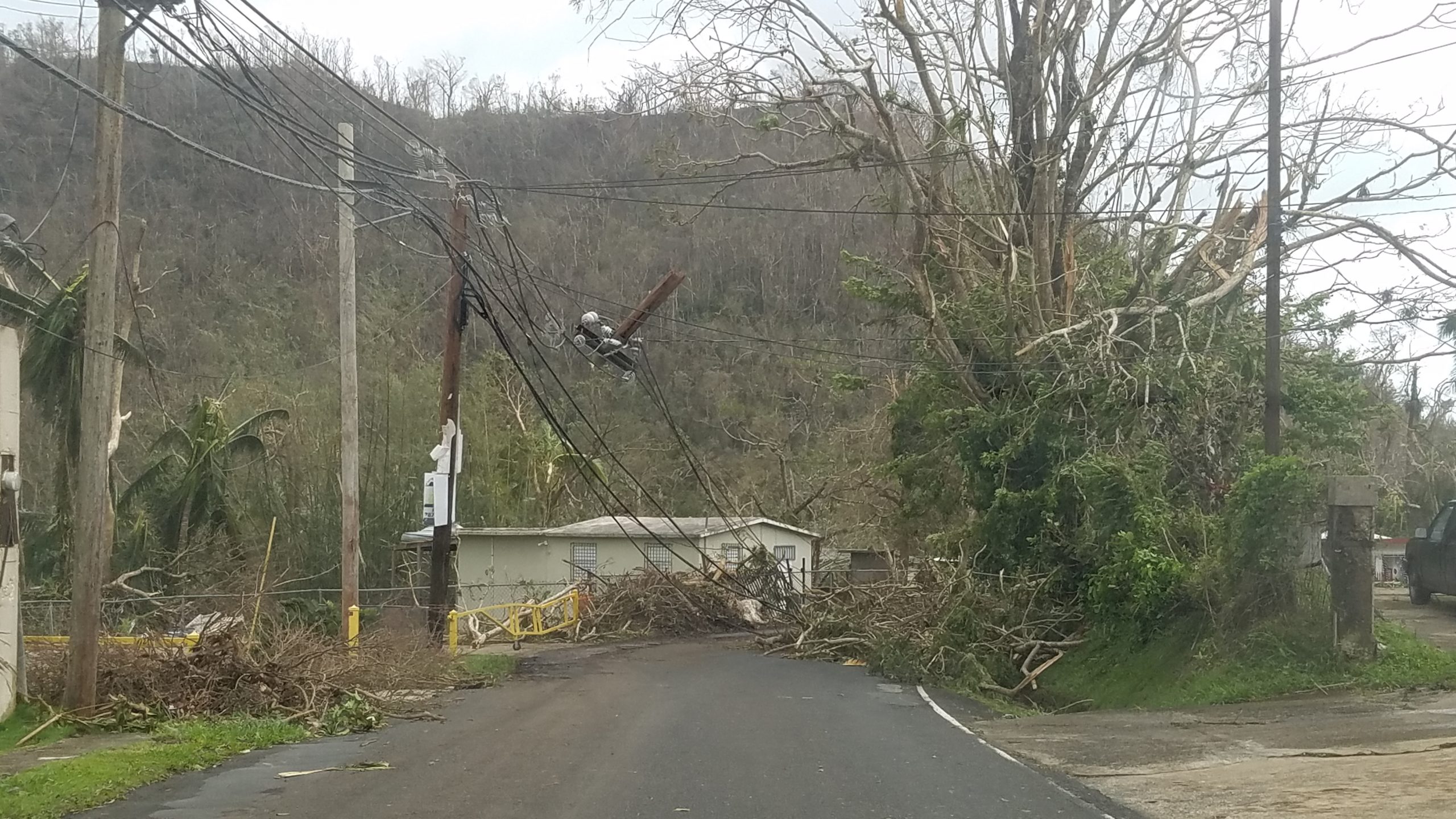
Hurricanes Irma and Maria
Hurricanes Irma and Maria tore through Puerto Rico in September 2017, wreaking unprecedented havoc on the rain forest, downing trees, shredding branches, and killing birds and animals. These photos from the US Forest Service show some of the devastation.
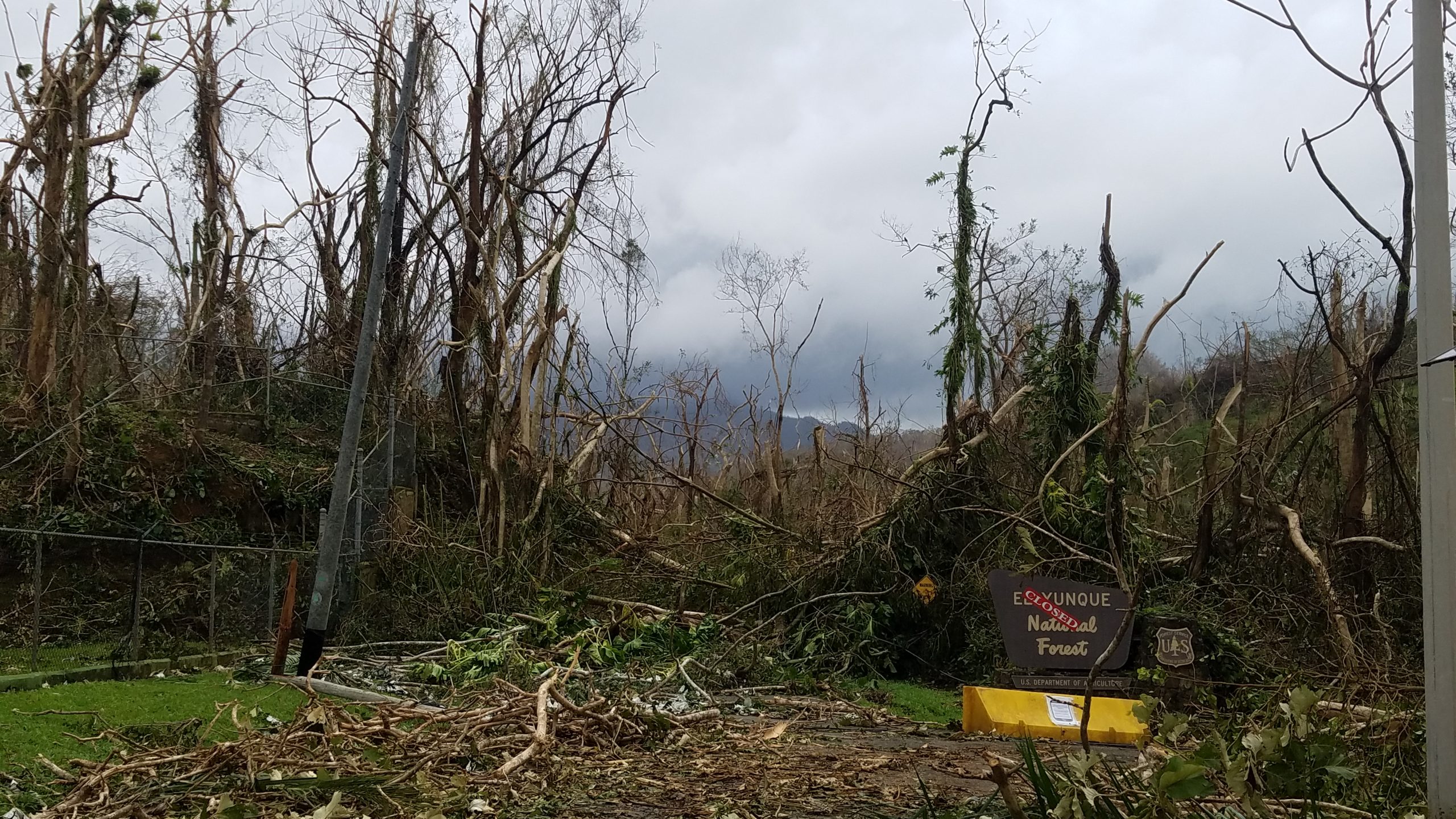
The Forest Service is still rebuilding, and Mina Falls, one of the most popular destinations at El Yunque, remains closed because of damage to its trails and bridges. A sign we saw said they are also using this rebuilding effort as an opportunity to improve the infrastructure to meet the demand of an increasing number of visitors. You might find this article interesting, which talks about the aftermath of the hurricane and climate change.